
Exploration of the underground
3D-seismic measurements in the area of the Asse II mine
The 3D-seismic measurements can help to improve the state of knowledge on the underground structure, the salt dome and the groundwater paths.
3D-seismic is a procedure with the help of which it is possible to examine the underground structure from the surface and to depict it spatially in detail.
The measurements provide data on

 3D seismic measurements can help learn more about the geological structure of Asse
- the overburden's structure,
- the geological structure, and
- the complex breaking-up or fault system.
Exact information about the underground and the groundwater paths is required to be able to guarantee safety for man and environment for the long period until retrieval operations will have concluded. Among others, measures to further stabilise and secure the mine can be derived from the data. The planned measures are in correspondence with the state of the art of science and technology and thus fulfil a provision set out in the Atomic Energy Act regarding the safe decommissioning of the facility.
Extent and start of measurements
An area measuring about 38 square kilometres around the mine is to be examined. However, before the scientists can begin their work, access rights and rights of way need to be resolved with over 700 owners in the planned measurement area. For this purpose, talks must be held with affected property owners, the communities, the rural district, the LBEG, and others. The Federal Office for Radiation Protection (BfS) had to postpone the planned start of the 3D-seismic measurement. After first talks, single land owners have indicated that they would not be prepared to grant access to their plots. However, to be able to explore the underground with the necessary quality, the BfS needs the residents' support in the region. Talks are still underway but an agreement or clarification cannot be predicted so far.

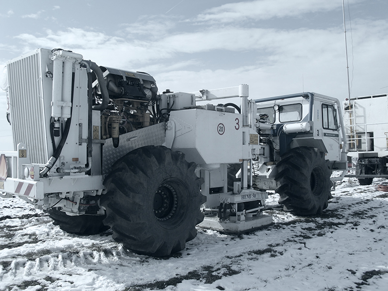 Vibration vehicles
Preliminary investigations and test measurements
For the main measurement, the BfS had a preliminary study commissioned in 2011 and a test measurement carried out in 2013. The test measurement has shown that the 3D-seismic procedure can be used successfully. Furthermore, the evaluation has provided and optimised important key data for the main measurement. Also, on account of the gained results, it has been possible to adapt the size of the area to be measured. The results of the preliminary examinations have been summarised in a final report. Finally, the BfS had the benefit and necessity of the complicated procedure reviewed by external experts.