
The 3D-seismics surveying method
")
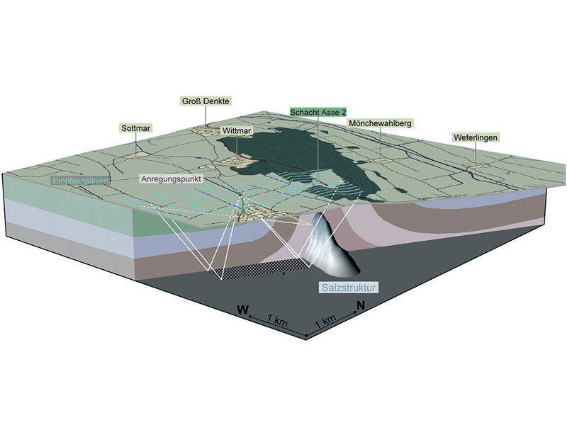 Pre-planning: Schematic diagram of the 3D-seismics (preliminary)
The three-dimensional seismics surveying method has been used for decades for the exploration of complicated geological structures, such as natural mineral deposits or (currently) geothermal energy and CO2 storage projects.
The principle of seismics is simple. It consists of the artificial generation of acoustic waves whose echo from the different rock layers of the underground is then recorded.
The artificially generated weak signals/vibrations spread wave-like from the earth's crust into the depth and are reflected by the individual rock layers. The reflected echo signals are registered at the surface with the help of geophones arranged in a network.
Generation of seismic signals

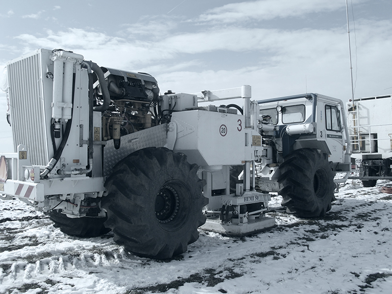 Vibration vehicles
For the exploration of the Asse, two approved techniques for the generation of seismic signals (vibrations) are appropriate. Their application depends on the conditions of the area to be surveyed.
Off-road or in the forest, small bore holes (e. g. two and a half to eight metres deep) are filled with carefully dosed small amounts of explosives and safely sealed. When they are detonated, only a slight tremor can be perceived at the surface.
In built-up areas, vibrators fastened to specially constructed vehicles are used on solid ground (roads and lanes).

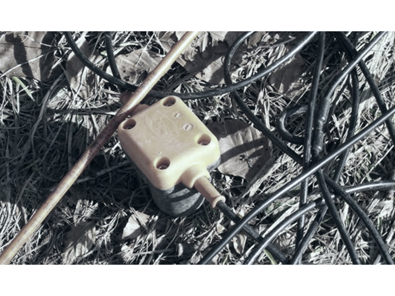 Geophone
Survey of the seismic signals
A geophone works like a highly sensitive microphone. It converts slightest tremors of the ground into electrical signals which are recorded in a surveying vehicle. The elaborate further processing of the collected data is done at the data centre with the help of high-performance process computers.
The area to be surveyed is in most cases divided into geophone lines which are measured one after the other. In these geophone lines, "geophone groups" are placed on the surface. Vertical to this, the shot point alignments are arranged.
")
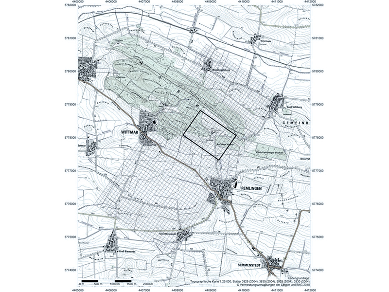 Survey map showing an example of a survey configuration (pre-planning)
Result: A comprehensive insight into the depth
The interpretation of results provides a three-dimensional image of the underground below the surveyed surface.
An optimum 3D seismics survey enables a comprehensive insight into the depth and forms the basis for a three-dimensional model of the Asse.