
-
Topics
subnavigation
Topics
Electromagnetic fields
- What are electromagnetic fields?
- Static and low-frequency fields
- Radiation protection relating to the expansion of the national grid
- High-frequency fields
- Radiation protection in mobile communication
Optical radiation
Ionising radiation
- What is ionising radiation?
- Radioactivity in the environment
- Applications in medicine
- Applications in daily life and in technology
- Effects
- What are the effects of radiation?
- Effects of selected radioactive materials
- Consequences of a radiation accident
- Cancer and leukaemia
- Genetic radiation effects
- Individual radiosensitivity
- Epidemiology of radiation-induced diseases
- Ionising radiation: positive effects?
- Risk estimation and assessment
- Radiation protection
- Nuclear accident management
- Service offers
-
The BfS
subnavigation
The BfS
- About us
- Science and research
- Laws and regulations
- BfS Topics in the Bundestag
- Links
Network improves user-friendliness of radiation protection data
The BfS is making nationwide radioactivity data available with a new version of the map application "Geoportal"

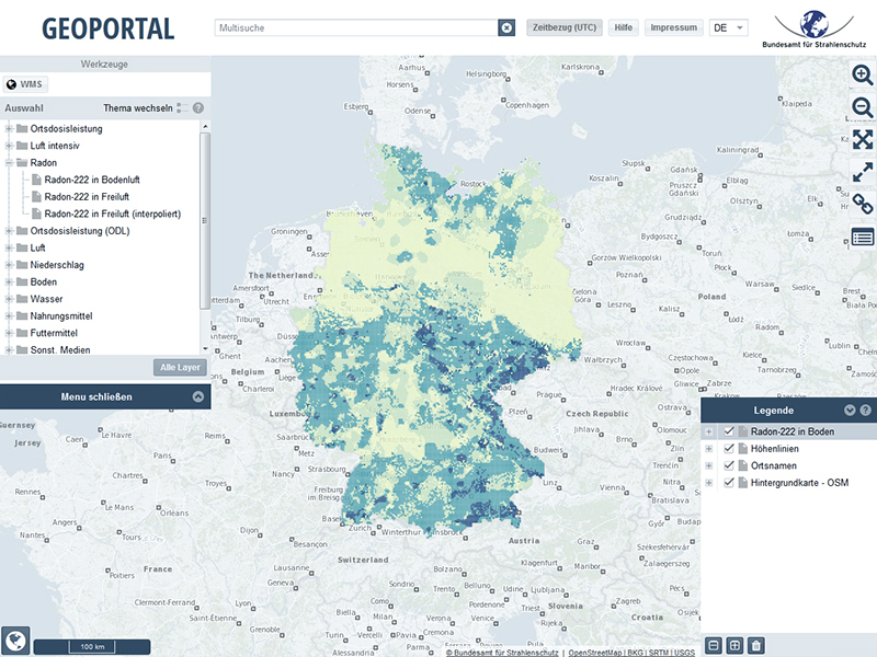 BfS-Geoportal
The BfS online portal for radiation protection data is now available in a new and completely revised version. This map application enables online users to view current data regarding radioactivity in Germany. Numerous data on natural radiation and artificial radionuclides can be found, such as radon in the soil vapour, the radioactivity in rainfall or Caesium 137 in food. With the Geoportal, the BfS contributes to the transparent presentation of data gathered by the authorities, publishing these and making them generally usable.
User-friendly information for the public on radiation protection
The BfS Geoportal is oriented towards interested citizens as well as local authorities, companies and professional associations. Its basis is an interactive map of Germany, on which different measurement values can be displayed. Search results can be restricted geographically, for example by using the zoom function or searching by location. The time ranges can be showed with a click so as to draw comparisons with previous measurements.
A large proportion of the data provided comes from the Integrated Measurement and Information System (IMIS) for the continual monitoring of the environment, which collects measurement data from the BfS and other authorities. The new design of the Geoportal is optimised for Smartphone and tablet - so measurement values can be retrieved quickly even when on the move. In addition, there now are more topics in higher temporal resolution and these are also available as a data download, e.g. the ambient dose rate values have been improved from 24-hour values to 1-hour values.
For specialist users, the data are also available via web services (standardised geo data services) such as Geoportal.de.
Contribution to the transparency of data collected by the authorities
Since 2013, the BfS has been making electronic data from the federal authorities freely available through the Geoportal. The inducement to develop the map application came from the European INSPIRE guideline ("Infrastructure for Spatial Information in Europe"
), which promotes a common geo data infrastructure in Europe to simplify cross-border data usage.
With the new, completely revised version of the Geoportal, the BfS is setting the course for the future by providing its measurement data as open data. The Open Data Law should improve access to publicly financed data held by the federal authorities. The regulations are currently the subject of legislative procedures.
State of 2017.06.02